Normally, I don’t have any issues eating and drinking enough when bikepacking. That did not carry over to Baja, and I don’t know why.
First, keeping up with hydration was really hard. Even though I covered up with a long sleeve sun shirt to keep the direct sun off of my torso, arms, and neck, the sun was still hot. As a Seattleite in the middle of winter, even the 80 degree F/27 degee C weather was really hot for me. I always had plenty of water and/or Liquid IV, I was never running low enough to have to ration. When I refilled my water, I would drink as much as I could straight from my filter. Yet I consistently experienced some symptoms of dehydration every day.
The more significant issue was my inability to consume enough calories to keep going each day. I had a constant supply of snacky food – peanut butter, some honey sticks, cookies, peanuts, snickers – available to me while I rode. More often than not, I didn’t really want what I had. None of the food was appealing to me. When I sat down to eat, I wasn’t hungry even though I knew I needed to refuel my body. I expected to be ravenous, consuming larger quantities of food than normal, yet my intake was less than I eat normally at home. This was incredibly frustrating for me – I was free to eat whatever I wanted and yet I didn’t want what I had.
I don’t really understand why this was. Since my past bikepacking experiences were all overnighters, I could manage even if I wasn’t eating well. Not eating enough calories across multiple days was unsustainable. I was bonking, hard, and it began to impact my mood.
So what’s next? I don’t really know. I need to keep working on finding foods that I actively want to eat while bikepacking that are calorie dense and enjoyable to eat. Andrew Skurka has a few recipes I’ve used that I like, and Garage Grown Gear has been my go-to source for mostly enjoyable pre-packaged dehydrated meals. But this was not an option in Baja where I was trying to be self-sufficient and live off the land… er… local markets. Sorry, Ryan van Duzer and Baja Divide riders everywhere, but bagged beans served at ambient temperature were not that great!
I’ve been home a few weeks. Hobbes went to the shop – no major issues, just needed a cleaning and some regular maintenance. The dragging brakes just needed to be adjusted. A replacement bike computer mount has been ordered. My other bike, The Pink ‘Rona, also went to the shop for a tune up. Both are ready to ride again.
Yesterday I was finally motivated to dig through my gear, reorganize everything into lidded plastic bins, and put it all away. Getting ready to go was so much easier than putting things away after the trip.
I’ve spent a lot of time thinking about my trip. What went well, what didn’t go well, and what I would change next time. Here’s some of my thoughts, in no particular order.
What went well?What would I do again?
First, I maintained a spreadsheet of all of my gear, where it was being packed, and how much I needed (e.g. “16 advil, packed in a mini ziplock, inside the first aid kit”). The spreadsheet really helped me think through all of my needs and ensure I didn’t forget to pack anything. If anything, I overpacked (see below).
Second, I have always been obsessed with maps. If you’ve ever been on a video call with me, my office has a huge wooden map on the wall behind me. I pin everyplace I’ve been. So I had obsessed over the maps of the routes. I knew where to expect water (and still found it where I didn’t expect it), where different options were if I needed to bail out for any reason. Everything was mapped in Gaia and RideWithGPS and available online or offline on my phone. This was a source of comfort and provided options when needed.
Third, speaking Spanish wasn’t an absolute necessity, but it did make things easier. Knowing the local language helped me speak with people I met along the way, learn about the road ahead, find a place to sleep, etc.
Finally, I packed and unpacked my bike multiple times before the trip. That gave me a lot of comfort that it wouldn’t be a problem in Mexico.
What went wrong? Why was I unable to complete the loop?
There were a couple of things I didn’t do well that made my ride more difficult than it needed to be.
I chose gearing that worked on shorter climbs near home, without considering how I might feel after a day or more of riding. This might have been OK, if I had ridden more in the months leading up to the trip, especially on a fully loaded bike on back to back days.
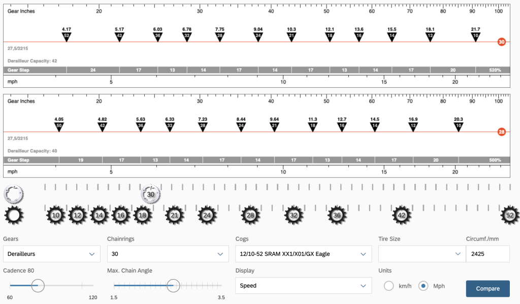
A slightly lower gear ratio with closer spaced gearing at the low end would have been incredibly useful. There were a number of climbs where I needed gears in the middle of the ratios I had available. A SRAM 1x 30T with 10-52 12 speed cassette has a really low granny gear, but the SRAM cassette has wide gear spacing at the low end. Changing the front chainring to a 28T chainring and a Garbaruk 10-50 cassette will allow for a slightly lower low end with closer gear ratios in the places where it counts.
Visual gearing calculator. Current gearing is on top, the bottom show the changes to a 28T with a Garbaruk 10-50. Notice the closer gear spacing at the low end on the left.
I’ve never been one to choose the lightest bikes and components. There are areas on my bike where I could cut weight and make a significant difference in the base weight of my bike. Wheels and tires are the two biggest areas where significant weight savings is possible. Upgrades will happen over time, there are cheaper and easier areas to save weight in the immediate future (below).
The bigger issue I faced was simply carrying too much stuff. First up, food: I need to carry enough food to get to the next resupply with a little extra, just in case. Instead, I carried extra food from home – packets of tuna and chicken, an extra pack of ramen, individual packs of peanut butter and hazelnut chocolate spread, and a lot of electrolyte pouches – that I planned to consume over the entire ride (~10 days). I could have bought what I needed every other day, saved a lot of weight, and made my ride easier. When shopping, I need to ensure I only buy what I will actually eat and not much more. An avocado might survive a day bouncing around in a pannier, definitely not two.
Electronics are another area where I can save weight. I brought too many GoPro batteries and a GoPro charger that didn’t need. I could have brought two batteries instead of four and left the charger at home. I’m not sure that I needed the second 10,000 mAH battery pack. Both the Wahoo Bolt cycling computer and Garmin inReach Mini can go for 2 days (or more) between charges, as can my headlamp. I didn’t use my headlight, so it didn’t need to be charged. I need to play with this more and see how far I can go with one battery pack to recharge and run my tent lights.
I’m not sure if I brought the right cooking kit, but I was only camping two nights, so it’s a bit hard to say. The Firebox Nano stove didn’t get used for a fire as I had hoped. I only used the Trangia inside the Firebox Nano once to heat up water for coffee. I didn’t use the titanium fork, knife, or tongs. I carried ~300 mL of stove fuel that was never used. Clearly I have some space to optimize for both space and weight.
I started riding too late almost every day. Packing up took longer than planned, my pump needed to be taken apart to lube the o-rings before pumping up the tires, Lupe’s tour was longer than expected, etc. Leaving late ensured that I was riding through the hottest part of the day almost every day. I need to pack more efficiently, cold soak breakfast, and generally get moving earlier in the morning. An early departure allows me the time to get off the bike in the hottest part of the day. I can use this time to sit in the shade, drink water, and eat a filling lunch.
I’m not sure why, but I slept terribly on this entire trip, even when I was in a bed. The nights I spent camping were uncomfortable with a new, untested pillow. The Nemo Fillo didn’t work for me – it was too small and thin, and too bulky when packed. I’ve replaced it with a Sea to Summit Aeros Down Deluxe which I hope works better for me on future trips.
My sleeping kit was ok… I don’t find the Kammok Bobcat quilt to be very warm, especially for it’s weight. I’d like to replace it with a lighter, warmer, more compressible quilt. A warmer quilt will allow me to leave behind the Appalachian Gear Company sleeping bag liner, saving a lot of space and about a pound of weight.
Will I do the Cape Loop again? Time will tell. I have other things I want to try to ride, or to ride again. Plus, there are other parts of Mexico and the world I want to explore. In the next few weeks I’ll be traveling, minimizing my cycling time. In the meantime, I’m looking for a route for early April within driving distance of home… I learned a lot on this trip that will make the next trip easier.
I woke up early today, still dehydrated. A liter of water and an unheatlhy breakfast – the Snickers bar was the healthiest thing I ate this morning – and I was ready to head out the door.
Ready for the ride back to San José del Cabo.
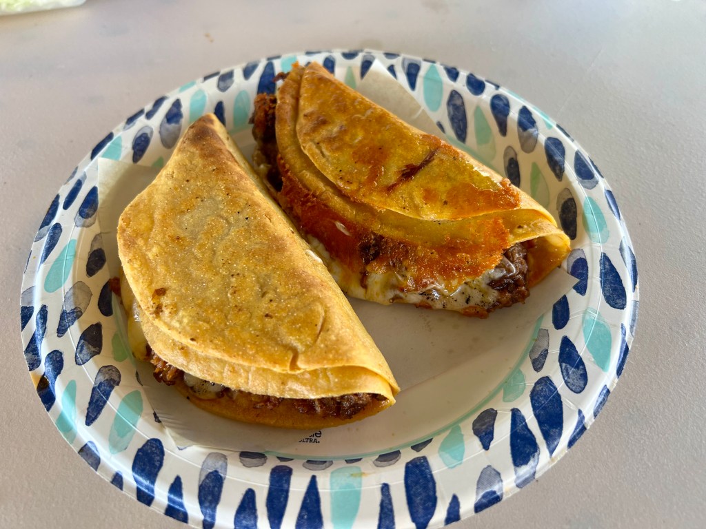
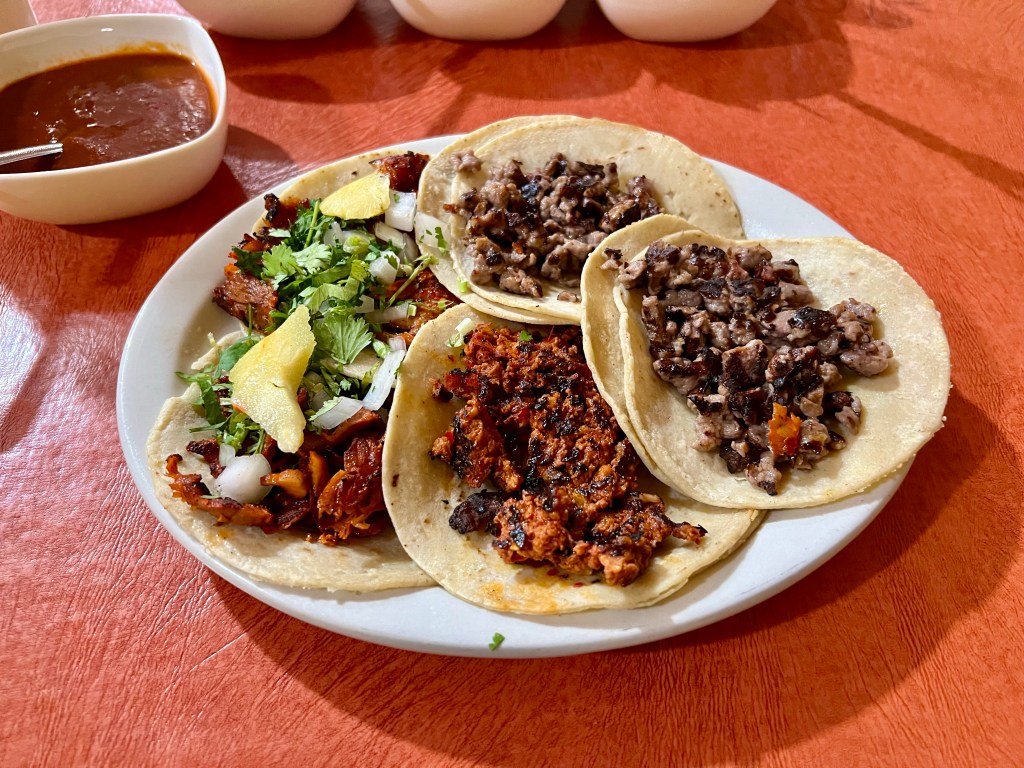
I took a shuttle back to the Cactus Hotel where my adventure began a week earlier. After a ~2 hour ride, with a quick stop in Los Barriles for cash for the driver, I was back in San José del Cabo. I hosed down the dirt from Hobbes before breaking the it down and repacking Hobbes for travel. I changed into fresh clothes I had left at the hotel, and headed up the street for some local food before heading to the airport. At the recommendation of the front desk clerk at the hotel I found delicious quesabirria tacos, consomme, and a half liter of coke.
A pair of quesabirria tacos from an unnamed street vendor.
A comically tiny car came to the hotel to take me to the airport – I’m not quite sure how we made the bike bag fit, but it did. I checked in to my flight a few hours early and headed to the lounge where I sat and drank – mostly ice water – for a few hours while waiting for the flight home.
I was still dehydrated.
By the time we reached Seattle I was tired, hungry, and ready to sleep in my own bed. When I got home, I wrestled the bike bag into the shed, took a long, hot shower, and fell asleep. Unpacking and reorganizing my gear will wait for another day…
Am I happy I went? Yes. Absolutely.
Am I sad that I quit before completing the loop? No, I’m OK with the outcome. This was the longest and most ambitious bikepacking trip I had ever undertaken. And I was doing it alone. Things didn’t work out as planned. I learned from the experience and will carry that forward to the next adventure.
I had another restless night with super strange, surreal dreams. Since I was meeting Lupe for a tour at 7:30 AM, I had an early alarm to allow me to have breakfast and get my stuff packed before he showed up.
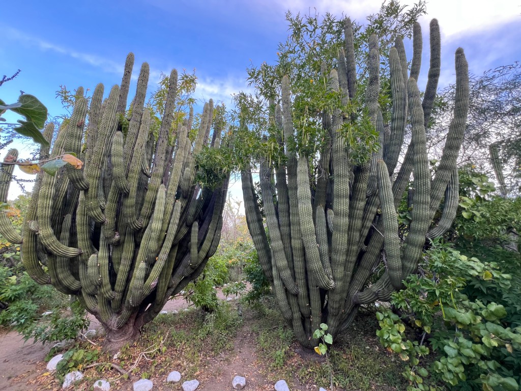
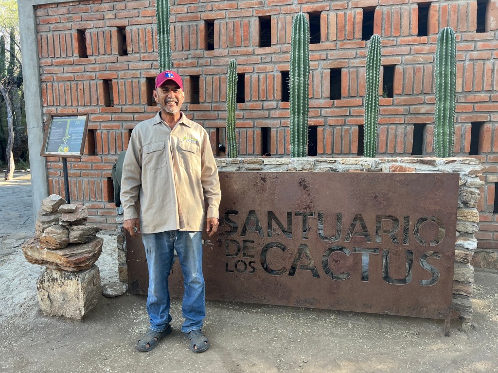
As promised Lupe showed up in the morning and gave me a very personal, in depth tour of the Santuario de los Cactus. Lupe shared with me that the sanctuary has been there for about 30 years. Six acres are protected with forty more acres surrounding the sanctuary waiting for fencing to protect it from local grazing animals. Lupe’s brother worked in the sanctuary for 28 years, Lupe has been working there since his brother’s death three years ago.
Lupe at the entrance to Santuario de los Cactus
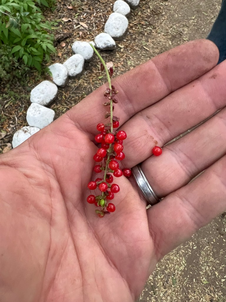
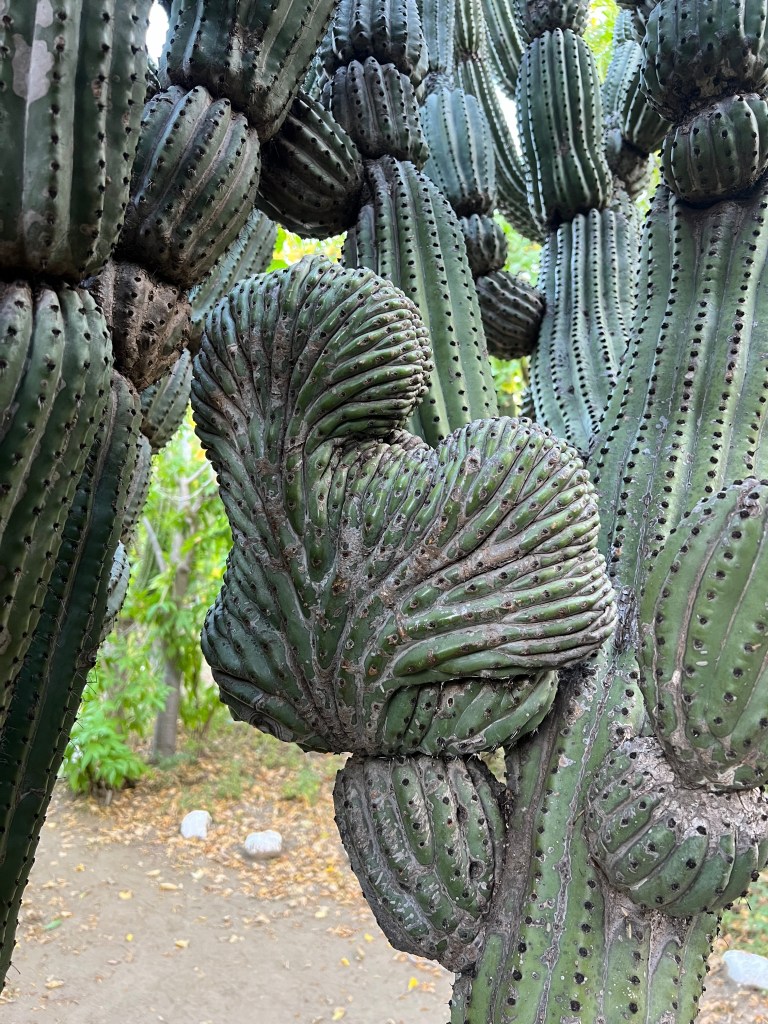
Lupe had a real connection to the sanctuary and its plants. He shared stories about the plants medicinal properties, pointed out spider eggs, local “cherries”, chiltepín chile plants, palo blanco trees with their incredibly straight trunks that the locals use to build structures, and all the different cacti. He showed me how the cacti “dance” when they’re shaken. I feel lucky to have spent time with Lupe and having him share his passion for the sanctuary with me. If you’re spending the night in El Rosario, make sure to ask in town for Lupe.
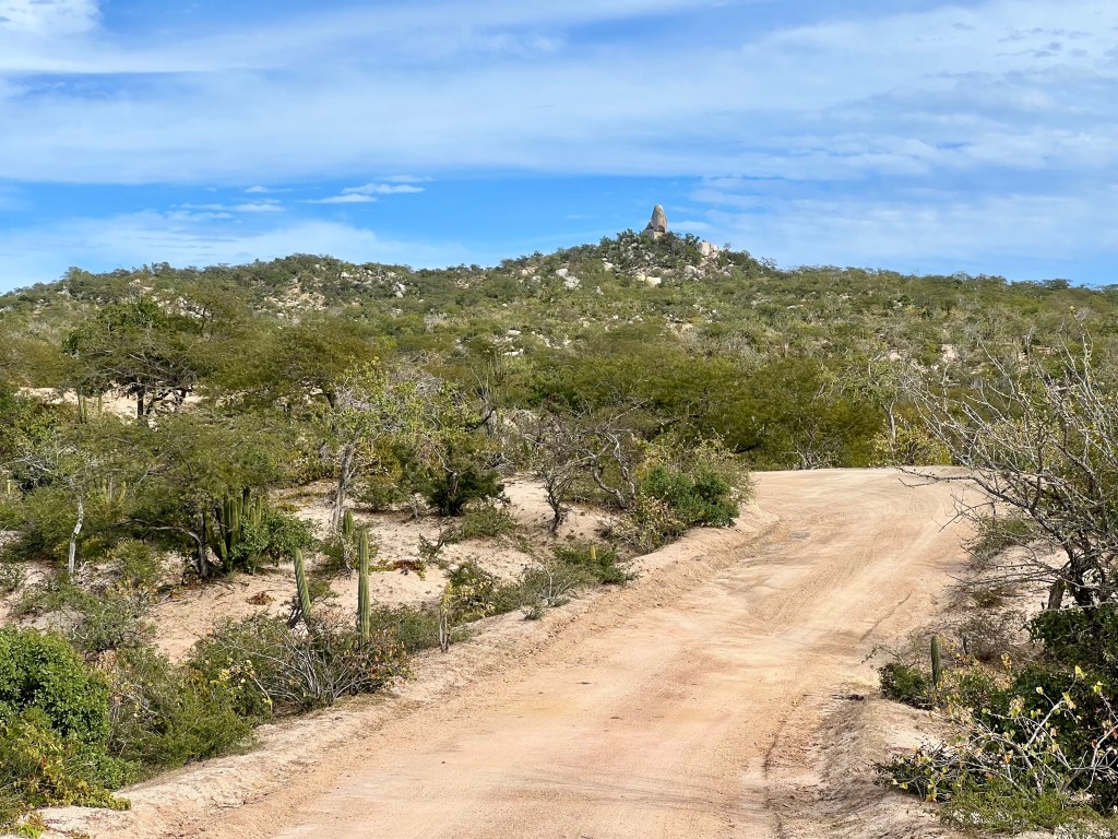
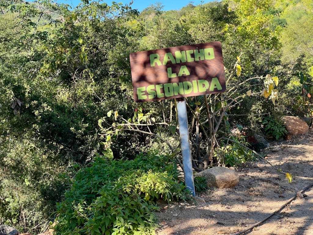
Departing the sanctuary, it was an easy dirt road for about 3 miles, followed by a 2 lane highway for another 7 miles before turning off on another dirt road. I knew the remainder of the route was going to be empty. Lupe told me about one store that I would encounter 5 miles down the road. There was a sign for Rancho Los Brasiles restaurant at the highway turn off. I stopped two guys in a compact car as they turned down the road and asked about restaurants and they enthusiastically told me to go to Rancho Los Brasiles before taking off down the dirt road.
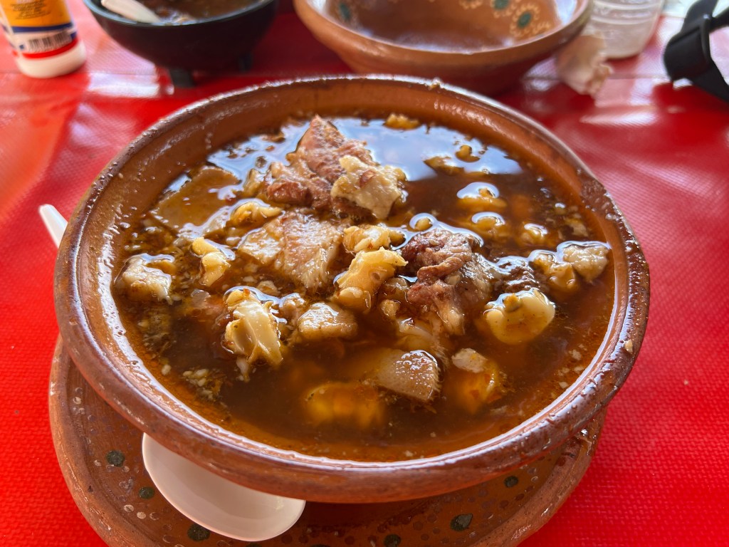
Posole at Rancho Los Brasiles
A little while later, I rolled into Rancho Los Brasiles and ran into my friends in the compact car. They bought food to go and were on their way out. The driver gave me a fist bump when he saw me and let me know he was glad I found the restaurant. I sat down at a table in the shade, ordered some pozole, horchata, and a liter of water, and had a leisurely lunch. I struggled to eat all the food – again – before heading back to the main road for the mostly deserted stretch between through ranch lands on the way to La Ventana. The road was very quiet, I only saw a few cars. One SUV slowed down to see if I was OK and knew where I was going. Even though I was still not eating sufficiently, I felt OK and started the climb to Los Divisaderos, a ranch near the top of the climb.
The climb was long and exposed, with a few steep pitches. My planned route took me off the main road to Iglesia San Blas, but seeing the deep sand between the main road and the church, I skipped the church rather than fight unridable sand. I wasn’t aware what I was going to face a short time later.
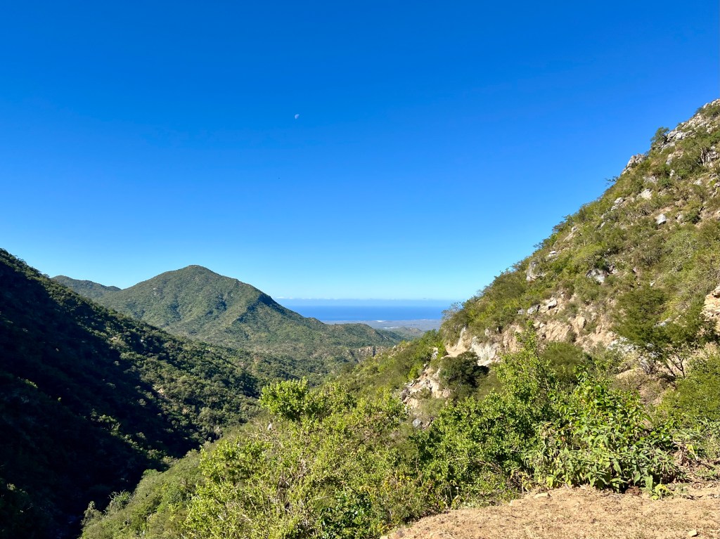
Passing through Rancho los Divisaderos I was chased by a handful of dogs. A few squirts from my water bottle sent them away, while I continued pedaling up the hill. Eventually, I crested the hill. Hot and tired, I was looking forward to the next few downhill miles to cool off, and enjoy a fun descent all the way down to the Sea of Cortez. I came around a bend and could see the lowlands around Los Planes and the sea beyond.
Around the same time, I received a handful of texts. I was once again in an area with cellular coverage. I had a quick chat with my wife before Hobbes and I set off downhill with visions of tacos and beer filling my stomach in a few short hours…
Minutes later, everything changed.
Looking NE toward Los Planes and the coast.
Riding down a non-technical section of the road there were long stretches where the road was divided lengthwise by channels formed from water runoff. The channels run roughly parallel with the road, requiring me to maneuver along the channels, riding the high, uneroded road bed as much as possible. A momentary loss of focus and I watched as the front wheel dropped into one of the channels, caught the edge of the channel on the right side, and threw me off the bike.
Physically, I was in OK shape. In the crash, I came off to the right, skinning my knee. My right elbow and shoulder were sore from landing on outstretched hands. I pulled out my first aid kit, bandaged up my knee, and checked out Hobbes. I’m not quite sure how this happened, but the crash bent the arm which my cycling computer and GoPro mount to. Not a big deal. Everything else seemed fine at the moment.
Except for me.
Back on the bike, heading down the hill, I was feeling pretty low. Accidents happen, yet I was second guessing everything I had done leading up to that moment. My tiredness contributed to my loss of focus and the crash. I began to consider what would have happened if the crash was worse? I hadn’t seen any humans in an hour or so, and that was on the other side of the pass I had just crossed. My mobile phone had service and my satellite messenger was available in case I really needed help, though it could be hours before help arrived. Instead of focusing on the fact that my bike and I were both intact and able to continue onward I started down the path of worst-first thinking. This is a helpful skill at my day job, but not so helpful at this moment in time.
Then I started mentally working through the calendar and the remainder of the ride I had planned. Could I get to La Ventana, and stay an extra rest day? If I did, I’d have to go three days straight to get back down the coast to San José del Cabo. What if I try to take an easier route tomorrow as I head toward the coast? I was thankful that I had studied the route, I had a reasonable mental map of my options for the next few days and could figure out a plan.
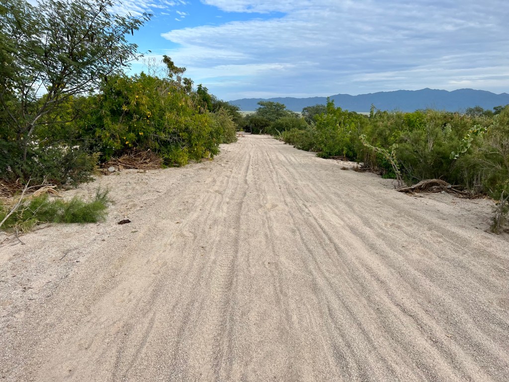
About two miles past where I crashed I ran into sand. Deep, miserable sand. The next five or so miles alternated between barely rideable sand and absolutely unrideable, get off and push sand. Over the next 90 minutes I would alternate between riding, pushing, and loudly cursing at the damned sand. At the same time, both brakes began dragging and squealing with each revolution of the tires.
Miles of sand.
The sand broke me both physically and mentally. During this push I decided my Cape Loop ride was done. I could choose to be stubborn and try to continue onward at the risk of hurting myself or finding myself stuck in a more difficult position. The better, wiser choice was to get myself to town and figure out way to get back home a few days early.
First, I have to get to the highway and then ride into town, chasing the fading light and my waning energy levels.
I made it to the intersection of the highway and the road to La Ventana. Contemplating my options, I stuck my thumb out for a ride. Within 2 minutes, a truck with Oregon plates turns on to the road to La Ventana and pulls over. Vince steps out and asks me how he can help. I texted him the GPS coordinates of my AirBNB and he helped me put Hobbes in the back of his truck. I hopped in the back with Hobbes and rode the last few miles into town with Vince. He dropped me off at the AirBnB and let me know he would text me information on a recommend a bike shop in town or, if I wanted, a transportation company to help me get back to the airport in San Jose del Cabo.
Thanks, Vince, your generosity reminded me that there are good people in the world who do things out of kindness and care for others. (Vince texted me the next morning and again a few days later to make sure I got home ok. We need more Vinces in the world.)
Inside the AirBNB I took a shower, switched into clean(er) clothes, and walked a few blocks for dinner and a beer. I called Delta and they changed my return flight to the next day (at no charge! Thanks, CS agent Stephanie!). Vince hooked me up with a shuttle driver for transportation to the hotel in the the morning.
I repacked my gear for tomorrow’s ride back to San José del Cabo and headed to bed.
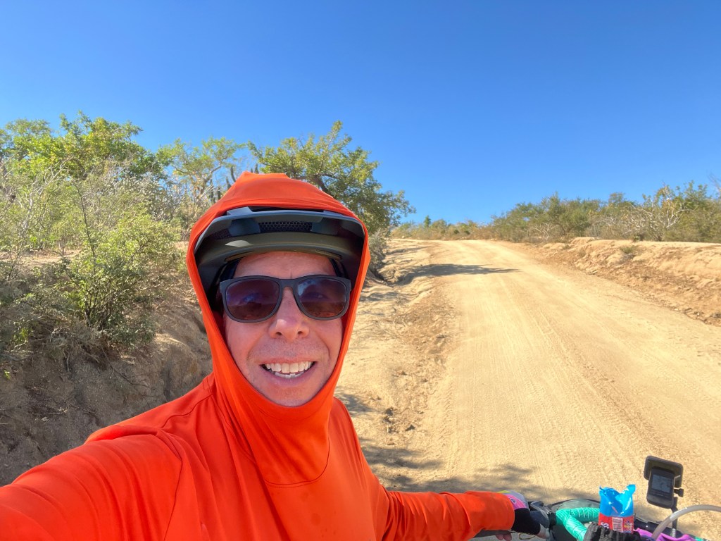
Today, I was up and out of the door early, riding by around 7:30 AM. As soon as I left my AirBNB, I noticed just how windy it was. The next few hours were spent fighting a steady 15+ MPH headwind riding along the highway toward La Paz. The noise from cars and trucks, combined with the constant wind noise was difficult to block out. AirPods Pro 2 can only do so much to reduce the outside sounds.
The highlight of 20 miles along the highway was finding myself at Lonchería la Garita. I happened upon the restaurant right around the time I was considering a lunch break, so I dropped in for a machaca burrito, some fresh pressed cheese, refried beans, tortilla chips, a large Fanta orange soda, and a bottle of electrolyte drink. After a welcome break from the highway, I hopped back on Hobbes for 6 more miles of pavement before turning east on a dirt road back into the mountains.
Lunch at la Garita.
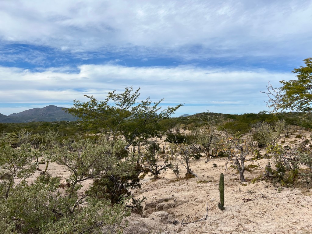
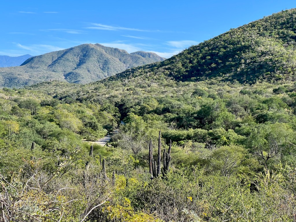
The next 8 miles was a mix of hard packed dirt and loose, rideable sand through forests of mesquite and cacti with roadrunners and doves all around. There were ranches on both sides of the road which means lots of cattle poop and the occasional cattle grazing along the roadside. I passed directly through one ranch, passing through a small herd of cattle and right past the ranch house. Eventually I reached the north end of el Valle Perdido, the Lost Valley, where I turned north to ride into el Rosario.
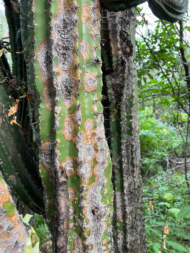
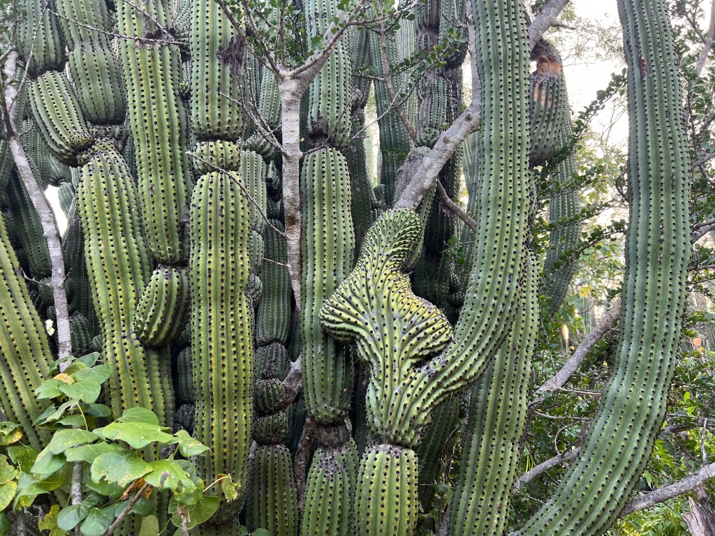
One of the very large cactus along the route.
In el Rosario I stopped in at the local tienda for four liters of water and two beers. I rode two minutes down the road to el Santuario de los Cactus and found it gated. Back to the tienda, the owners let me know they had called Lupe and that he would meet me at the sanctuary. I could let myself in – the gate was to keep the cattle out, not people.
Looking south into el Valle Perdido
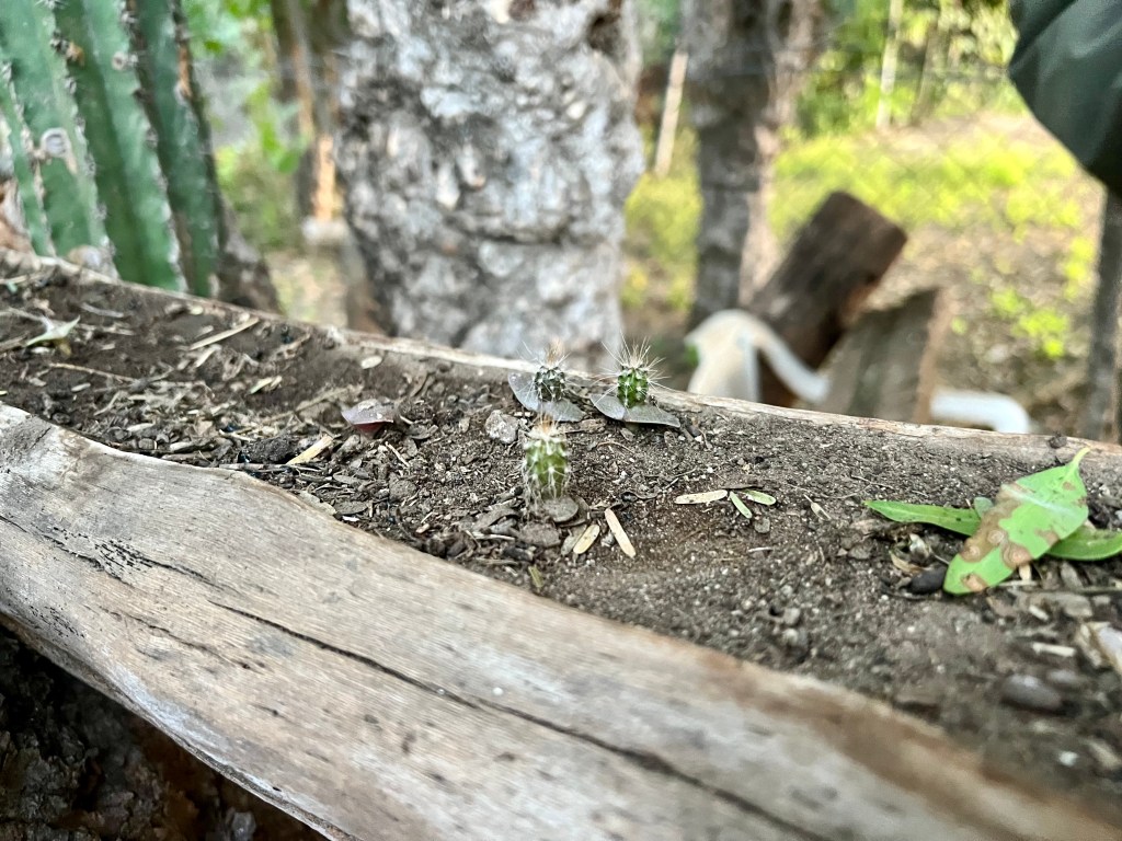
Back to the sanctuary, I let myself in and began to set up my tent under the future entrance building to stay out of the wind. Eventually a car drives up and I meet Lupe for the first time. Lupe is the caretaker of the sanctuary, a job he’s been doing for about 3 years. His brother was the caretaker before him for 28 years! Lupe shows me around, sets me up with a nice fire, a grate to cook over, and a chair to sit in. He proudly showed off the baby cacti he planted. I had no idea that cacti sprout with a pair of cotyledons! Lupe left with a promise to return at 7:30 AM for a personal tour of the sanctuary.
I made a quick dinner which I ate by the fire. I consumed at least a liter of water and a pair of cans of Tecate while reading by the fire. Tired, I put out the fire, climbed into my tent, and listened to an audiobook until I fell asleep.
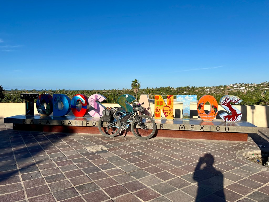
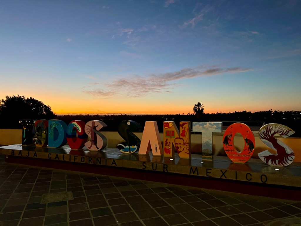
After a fitful night’s sleep, I decided to stay in Todos Santos for a rest day. I ate a lazy breakfast and then dropped by the bike shop in town. One of the guys at the shop gave me good information on the next section of the route. I extended my AirBNB stay for another night, which gave me the opportunity to nap, lay in bed, read, and stay out of the sun. Which I did for about six hours – three before lunch, three after.
Tomorrow I plan to ride to El Rosario and Santuario de los Cactus. Taking the advice of a previous rider, I decided to take the highway (ugh) out of town to make the day easier. I’m still feeling tired from yesterday’s effort. The new route follows the highway for about 20 miles, before turning on to a local ranch road and meeting up with the official route in Valle Perdido. I restocked my food, repacked the bike, and went to bed early to be prepared for tomorrow’s ride.
I woke up early this morning to a beautiful sunrise over the mountains. After a quick breakfast, I loaded up Hobbes and we headed off for the day’s first challenge – a 4 mile/6.4 km climb up 1100’/335 m before dropping back down toward the Pacific Ocean on the other side. The climb took about an hour of riding, with a few delays along the way.
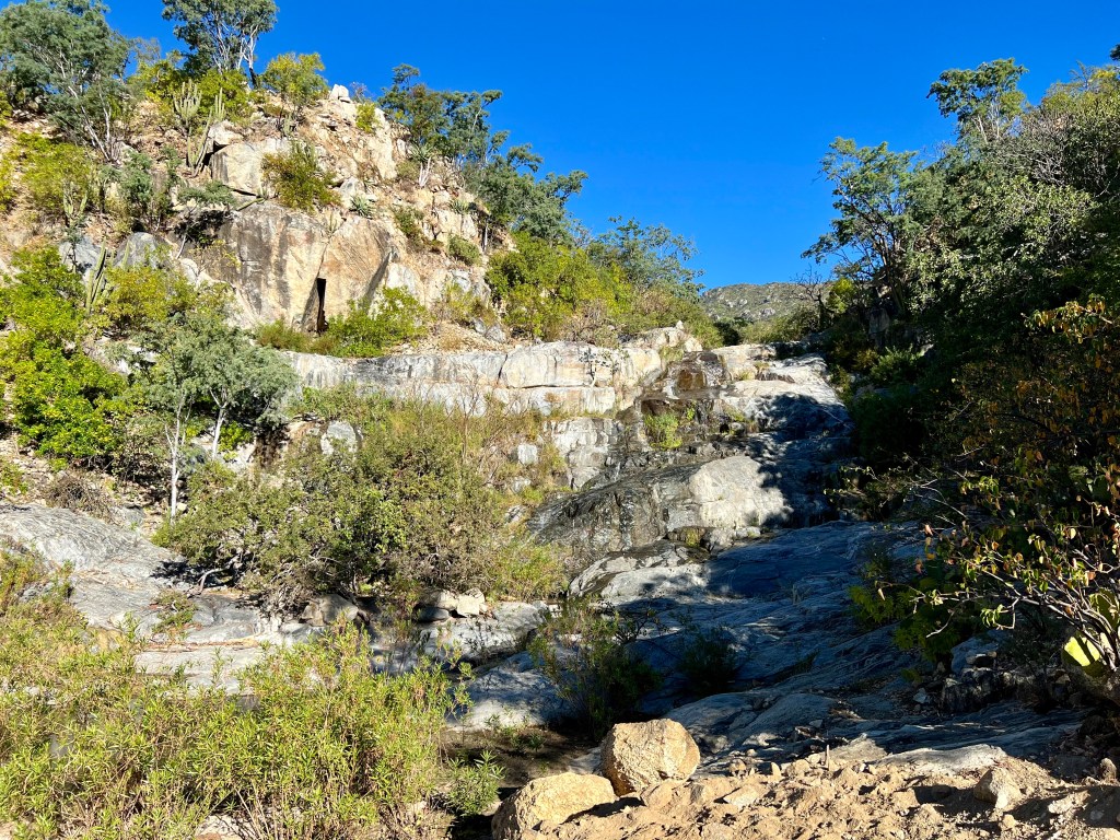
Waterfall next to the roadside.
The first thing I noticed was a noise coming from the rear end. I forgot to tighten down a strap, it was hitting the rear wheel which caused the noise. As I corrected the loose strap, I noticed one of the bolts holding the rear rack to the seat stay was also loose. Unfortunately, these bolts are on the inside of the seat stay. To tighten it properly means removing the rear wheel. I must not have tightened them completely when I put Hobbes together in the hotel room two days ago. Using the pliers on the Leatherman, I was able to tighten them sufficiently for the day.
One of many ranches found in the mountains.
Within another half mile, I was experiencing noise when in the granny gear. Thankfully, I had seen (heard?) this behavior before on Hobbes. For some reason, the B-screw on the rear derailleur seems to loosen on rougher terrain, causing the chattering and, eventually, poor shifting. I was able to improve the shifting with an adjustment to the B-screw, but I didn’t recall how to measure the adjustment properly, so I couldn’t dial it in 100%. This would continue to give me a bit of grief, and something to worry about, for the remainder of the day.
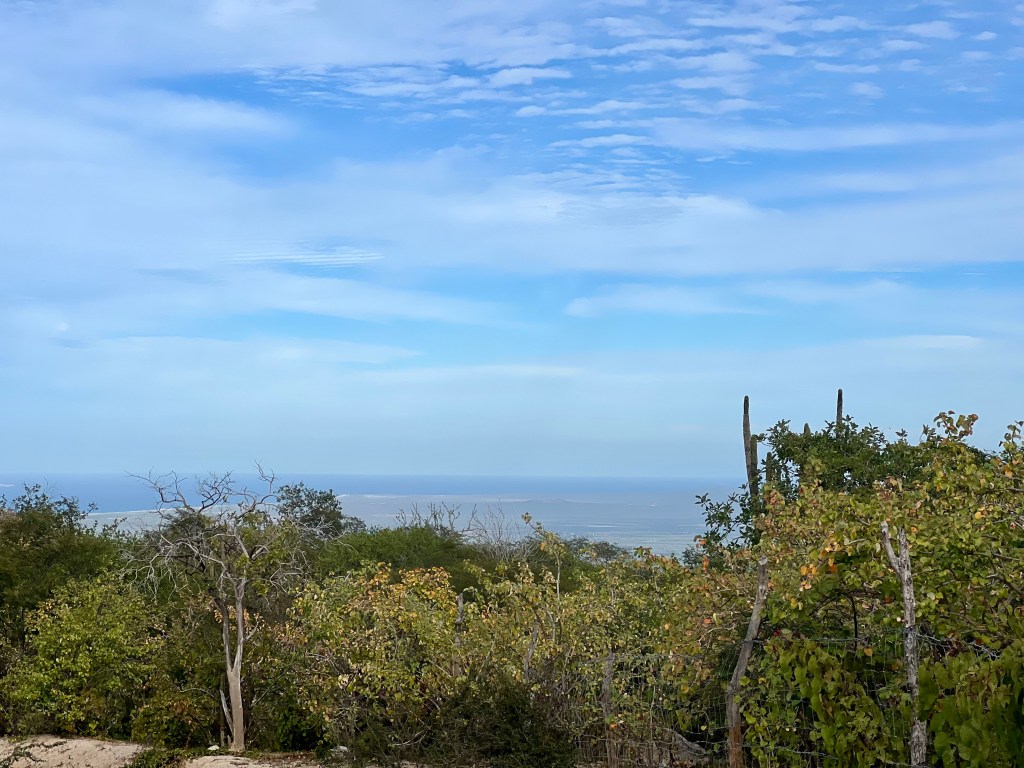
Eventually, I crested the pass, and was greeted with the sight of the Pacific Ocean in the distance, followed by a long downhill with many streams crossing the road. I continued riding to el Aguaje, a small ranching community where I refilled my water in the flowing stream, drank as much as I could stomach, and sat down under a broad tree to have lunch in the shade.
My first view down to the Pacific Ocean.
I made the decision to head toward the coast highway (MEX19) instead of following the route along mostly dirt roads all the way to Todos Santos. This was in an effort to avoid what I had read was a difficult, sandy section. Looking back, I should have continued further north on the backroads before heading west to the coast at el Pescadero or continued all the way until Todos Santos. Lesson learned.
The route to the coast road was nice, not too washboarded, and not too sandy except when it crossed a dry arroyo. Thankfully, I crossed the arroyo immediately before a large group of off-roaders came tearing through, creating a huge dust storm all around them. No wonder one ranch had signs in Spanish and English asking off-roaders to drive slowly.
My route took me west to Rancho Nuevo, and then north along the highway MEX19 toward el Pescadero. I don’t enjoy riding on the highway. It’s loud, dirty, and uncomfortable with traffic passing by at 60 MPH/100kph+.
I stopped at the first tienda I came to where I bought a Coke and something to snack on while sitting in the shade. With the derailleur still making noise, I hopped online and found a bike shop in el Pescadero that I could ride to before dusk. Hoping to get a quick repair before heading onward, I arrived to find out that there wasn’t a bike shop there at all.
Climbing the hill just west of el Aguaje.
Dejected, I managed to find a ride the last few miles into Todos Santos. I checked into my AirBNB, had a well deserved shower, and went out for tacos.
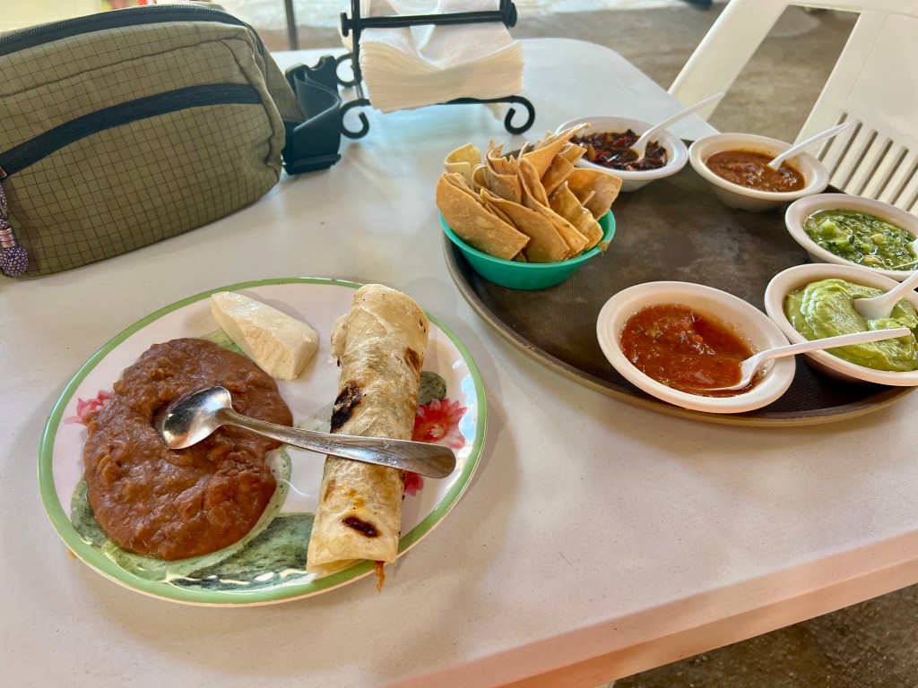
Today was difficult. I couldn’t keep hydrated even though I had plenty of access to water. Worse, I wasn’t hungry. Not a bit. At dinner I ordered some tacos, an octopus tostada, and some guacamole. I couldn’t eat everything that I ordered, even though I had been pushing hard all day.
After food and rehydration, I cleaned up Hobbes, fixed up the derailleur (thanks for reminding me of the measurement I needed, internet!) and went to bed unsure of tomorrow’s plan.
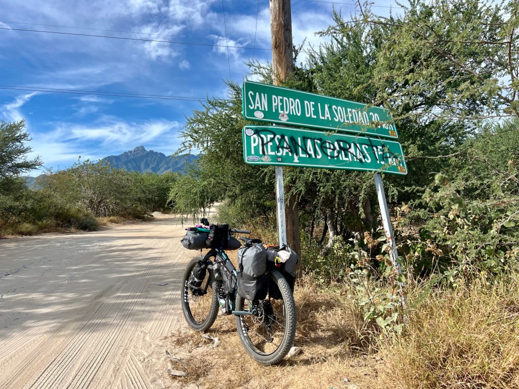
After a quick breakfast at the hotel, I headed off to the mountains. But first, I had to navigate about 8 miles through the San José del Cabo suburbs and along Mexíco 1, the highway between San José del Cabo and La Paz, to the north. Thankfully, there’s a dirt road running parallel to the highway for much of the route, so I was able to minimize my time on the road itself. (Note: the official route has recently been reported to be closing/closed. I’m not sad that I missed multiple miles of deep, unrideable sand.)
Adventure begins here, at the turn off from MEX1 on to the Camino Las Naranjas
From here, the route starts a steady uphill climb, crossing arroyos that cut through the mountainous landscape. The road has a fair bit of traffic, mostly ranchers (I assume), but I did see a few families out exploring and playing in the cool water of the arroyos.
I stopped at the first arroyo I came across for a quick break. I spoke to a local family out enjoying the day, they let me know that many of the arroyos have active streams now because of the late fall hurricane that hit this area. I headed off up the road, only to be passed by their car a few minutes later. We met again at the second arroyo. They stopped to play and make lunch, while I stopped to eat my cold soaked couscous before continuing onward.
The first arroyo.
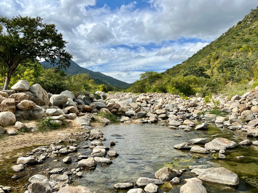
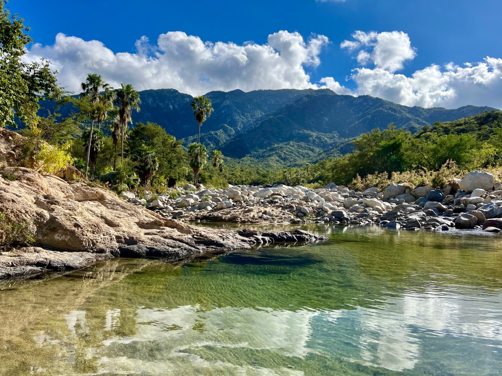
Continuing a steady climb into the Sierra de la Laguna I finally reached a downhill stretch where I came across the Buddhist retreat, Tsegyalgar West. This community owns a significant amount of land in the area, signs on both sides of the road notified visitors that the area is private property for miles. About a mile after the entrance to Tsegyalgar West, I came across a beautiful arroyo with a fast flowing stream. Sometimes called, “las pozas budistas,” or, “The Buddhist Pools,” I took the opportunity to cool off in the water and refill my water supply for the evening to come.
Las pozas budistas
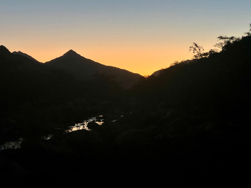
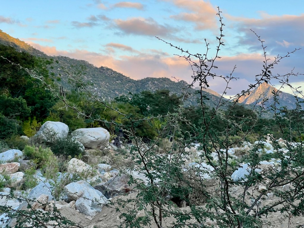
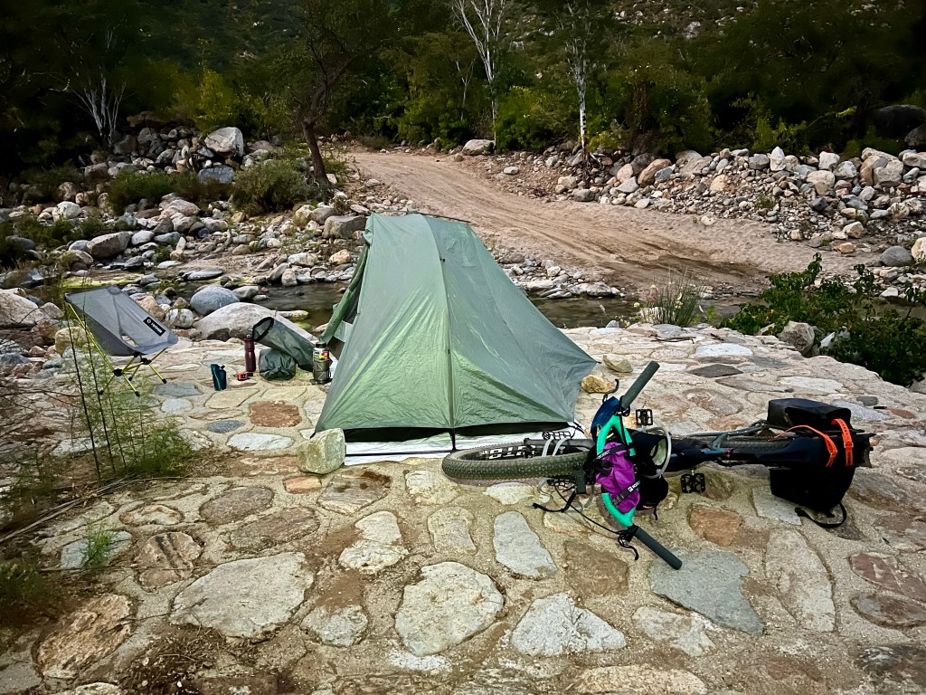
I continued on another mile or so before finding a great campsite next to another arroyo filled with flowing water. A steer laid down on the other side of the arroyo and watched me set up camp for the night. Once the sun set, about 5:45 PM, the clouds rolled in and darkness settled over everything. The heat of the day quickly faded and I went to bed before 8:30 PM.
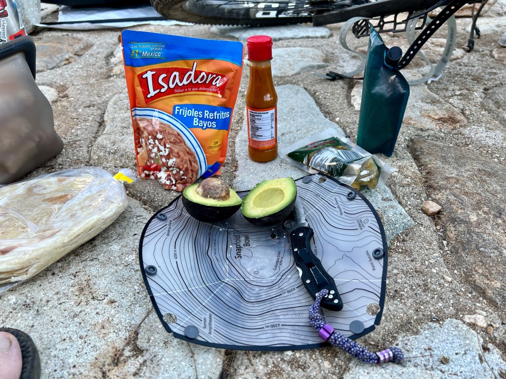
My campsite for the night.Dinner! Bagged beans, tortillas, an avocado, olives, and tequila.
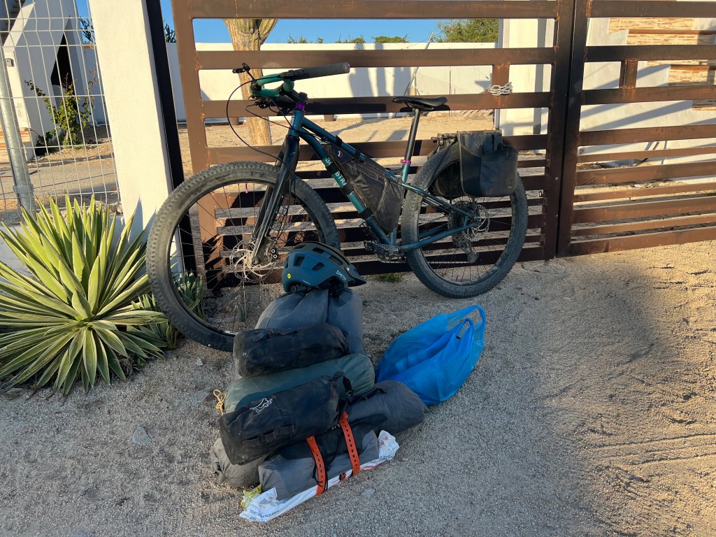
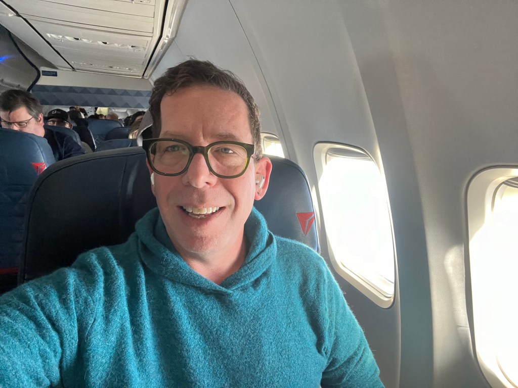
On January 1, I left on the morning flight to San José del Cabo. I was incredibly anxious about my bike – will it make it on the flight? Would it be damaged en route?
When I arrived in Mexico, I noticed the bag had been opened. The TSA had searched my bag. I’m fine with the bag being searched, but I’m displeased that they tried to remove my framebag, and broke a few pieces of padding between the franebag and frame, and left the bike unsecured in my bag. I have no idea what they were looking for – nothing was removed. Thankfully, nothing was damaged in transit.
I called the Cactus Inn Hotel where I was staying, they directed me to the area just outside the terminal where the rental car agency folks wait. They had a representative there for their car rental business (Cactus Rentals) who drove me a few miles to the hotel. I checked into my simple, bare bones room before heading off to buy groceries and get dinner.
Tacos at Taqueria el Fortachon.
Well fed, I headed back to the hotel to rebuild my bike, repack my bags, and head off the next morning. Tequila was involved, so building the bike took longer than expected. (More on this in two days…)
Off to bed early for my first day of riding in the morning!
(Nota bene: All posts for this trip are being back dated to the date that they occurred, even if I’m writing a few days later.)


You must be logged in to post a comment.